Tuesday, March 18, 2014

Ghana's Infrastructure - Electricity


Electricity generation is one of the key factors in order to achieve the development of the Ghanaian national economy-- allowing for rapid industrialization. Ghana has an immense need for electrification, particularly for its residents in rural areas who are still not on the grid. So, what are  possible sources for electricity; preferably those that cost the least in terms of environmental and economic cost? In short, hydro-power.

The map to the right showcases Ghana's most important river system, the Volta river. The Volta river system is made up of primarily three different drainage basins: 1) the white river referring to the sediments that the river carries, 2) the red river most likely referring to the predominant red color that also can be seen in the soil (more iron oxides, and 3) the black river most likely referring to the dark color that tannins from bark and leaves give the water. While Ghana has other rivers, none of them can come close in water capacity and thus in potential output of hydroelectricity than the system described above.


The map to the right shows the location of the three dams the country has. The Akosombo dam created lake Volta, the dam downstream from there, Kpong dam, was built because of its water capacity. The third and last dam to be built is the Bui dam.  


Overall, much of Ghana's electricity comes from hydro-power; there is a plan at work to produce more than 10% of the national energy from renewable energy resources (not counting hydro) by 2020.

Ghana's options for hydroelectricity are unfortunately limited; the third and possibly last hydro-dam was finished in February 2014 AND we got to see it.
Bui Dam, on grid as of February 2014


This might be the last hydro-dam to be built in the country because all other possible proposed sites do not yield nearly as much energy as these three mentioned above.


Here we are from left to right:
Judy, Cass, me, Kwame and one administrator
Actually we were a group of eight in the van but the others did not appear for the photo.

View onto the resulting reservoir lake:
Overall, about 1,200 people had to be resettled; they all received a new house with one room more than what they originally had and a piece of land not to exceed 5 acres even if they had more land than before. They have now well-dug fresh water and most likely electricity which is not the norm in this remote part of the country. They do not have fishing rights yet but will get those as soon as the construction of the dam is 100% finished. The generated electricity is fed into the national grid for consumption for all.

Ghana's national electric grid looks like this (map to the right). Most of the electricity is generated and used in the south of the country, the Bui dam is the only one in the northern part of the country. 

According to a wikipedia website Ghana  has been an electricity exporter since 2007 and  an exporter of crude oil and natural gas since 2011.

50% of the electricity goes to the residents, leaving about 47% for industrial and commercial consumption. Some of the electricity gets lost in transmission also.


Religion in Ghana


Population density, Ghana
Like most West African countries, Ghana is mostly Christian in the south and mostly Muslim in the north. Historically, Christianity entered the country by way of missionaries debarking from European ships at the southern coasts while Muslims came from the northeast after the Arabization of North Africa. While the map above may not accurately reflect the distributions of Muslims (there is some debate; the Muslim minority definitely reaches further south) it helps in understanding why religions are so mixed in some countries.

Given the country's  population density   realities (map to the right)  means that Christianity overall dominates, with only around 15 percent of Ghanaians following Islam. .Source


Christian Church, not Catholic

Christian 71.2 (Pentecostal / Charismatic 28.3%, Protestant 18.4%, Catholic 13.1%, other 11.4%), Muslim 17.6%, traditional 5.2%, other 0.8%, none 5.2% (2010 census). Source


The cultural landscape pays tribute to both faiths, there are a lot of churches and mosques all over the country, in rural and urban areas, poor and rich. It is interesting to note that while the first Christian missionaries had to be Catholic, Catholicism is not very strongly represented here, an observation which corresponds with the numbers of the CIA source above.


Mosque with Minaretts
According to the CIA numbers above, there are about 5.2% traditional believers, believers in animism. I have my doubts whether this is correct  but do not know how the statistics came about. It appears to me from talking to Kwame who is a devout Christian that it is quite possible to be a Christian and a believer in animism as long as one follows the rules of all. This would be similar to Japan where it is possible to to be an adherent of Shintoism as well as Buddhism.


Larabanga Mosque, oldest Mosque in Ghana
In the northern section of the country one can find Ghana's oldest mosque  dating back to 1421--it was erected during the trans-Saharan trade. It is located in the middle of a village with the name of Larabanga, not too far south of Mole National Park.
Courtesy of Wikipedia


The trans-Saharan trade was based  on the exchange of salt from the middle of the continent and gold from the coastal regions; thus the Mediterranean economies were connected to the sub-Saharan economies. It was this trade that ultimately brought Islam to the Ghana region. A lively slave trade with slaves being exported to the north of the continent and Ghana importing trained soldiers. 

Slaves were quite common in Ghana; Kwame said that his great-grandmother still had a slave. I am not sure when that would have been--maybe 150 years ago??


Monday, March 17, 2014

Ghana and Development, Part 2

35%-40% (inclusive mining) of Ghana's income depends on the primary sector
Source: this webpage
Looking at the graph above, please note there is very little manufacturing, most of the country's income comes from its natural resources which includes gold. Check this article for Ghana's gold production and its recent decline. Our van driver told us about illegal gold production in which he participated till he had an accident; he came out uninjured but not everyone is so lucky. Just like in the Amazon area and beyond, i.e. in Brazil and neighboring countries, people hope to get rich fast, they dig on the surface and also below ground to get to the desired metal, they use mercury to separate the rock from the gold in the process of which they endanger themselves as well as the environment. 

On the African continent Ghana is the second largest producer of gold after South Africa. If you are interested in the topic here is a book I can recommend; it is about a South African mine and its effects on the people. It is called Gold and the link will get you to an interview with the journalist author. 

House Building


The photo above shows how houses are built in most of this area--first there is the framework out of wood, then the walls get filled it with moistened soil (=mud) which will dry and be as hard as rock. The color therefore is that of the soil, sometimes this gets plastered over with more moistened soil of a different consistency for smoothness.

Farmsteads
The farm belonging to Kwame's brother is similar to that of Kwame--a large square surrounded by the necessary farming sheds.
The square--center of the farm. To the right: food storage shed.
The food storage shed was kept very clean, the walls and floor were very smooth--most of the foods kept were dry foods and/or bananas. This is due to the absence of refrigeration.

The dishes get washed in the center of the farm; there is neither sink nor faucet nearby.


From the Soil to the Plate
The most important staple food in this part of West Africa is cassava, a carbohydrate. It is grown in large fields and can be harvested for about five years. It is a tuber, so when the tuber is harvested, the plant will be placed back into the soil. After five years the cassava tuber contains too much cyanide and the plant must be replaced by a new plant. Again, this is done manually by taking the entire plant out, harvest the tuber and pant a new cassava plant. Below a cassava field:
Here is a photo of the cassava tuber being brought to the market :

In the photo above you see a young man pounding the cassava roots into little pieces--water is added to make the mixture smooth. If plantain is added to the mixture, the dish will be called fufu. Below you see fufu with a fish.
The dish is properly eaten by 1) washing your hands with soap --bowl to the right--and 2) then eating with fingers. In between one can wash one's hands.
Fufu is served with all kinds of stews; the one above is a popular one with cooked goat's meat.

Unpounded cassava pieces can be dried over heat and pounded at a time when needed--this is particularly important for rural areas without refrigeration.

Sunday, March 16, 2014

Ghana and Development, Part 1

Well in the center of the village where Kwame spent much of his childhood

When traveling Ghana one is forced to see how life is for the majority of people in the country, sugarcoating the experience is really not an option because poverty is visible everywhere.  So, I am going to use my exchange partner’s life story to start delving into the topic of development.

Please know upfront--the Ghanaian people are the nicest, most gracious people I have ever encountered. Their big smiles make the world richer, their knack for making do with very little is remarkable, their sense of presenting themselves as clean and well-dressed people is impressive. They have a very strong sense of community which translates down into every village--it was clear for us to see that the kids could roam free  and that they were safe because there isn't much danger in villages. They also had an innocent happiness about them which might stem from them not being exposed to TV. Of course, they'd also have to do their chores. Overall, the warmth that we got to experience through our Ghanaian exchange partners and through them also that of other people might be something we want to work on.

My exchange partner Nana Kwame Baah-Korang is the fourth of five children born to illiterate parents; he has two older sisters and an older brother as well as a younger sister. His father spent five years in India during WWII as a soldier in the British army but then returned to tend to his farm in the interior of the country. They planted predominantly cassava and plantains.

The well depicted in the photo above did not exist in Kwame's childhood but the village the center of which is taken up by the well was Kwame's village and the closest to a 'downtown'  people here experienced. There is no electricity and no running water...and it is only 8 km (roughly 5 miles) away from the town Sunyani where such luxuries exist--not for everyone, though.

Kwame’s farm is located a relatively short walk from the village, see picture below. He has workers who run the farm. The farms are located within  the plot of land and are thus rather isolated. 
Nana Kwame's farm
The farmhouse, living areas and sheds are arranged so that there is a square in the center where much of the daily activities occur; particularly the pounding of fufu (cassava, plantain and water), the pounding of palm kernels to make palm oil (see photo below) and the wash. The shed to the right contains goats.
Pounding palm nuts to make oil
Palm nuts look like this:

and come unsurprisingly from palm trees.
The dry fiber remnants of the material that was pounded to make the palm oil is often returned to the tree to dry. It will be used to start the fire for cooking.
In addition to palm oil, palm fonds (= the leaves) are used for thatched roofing for more traditional houses which was definitely part of Kwame's childhood cottage as well as brooms.

Kwame primarily plants cocoa trees the product of which he sells on the market. The photo below shows a view into the cocoa grove to the right of the path.
View onto the cocoa grove--Kwame owns eight acres
Below you can see how cocoa grows on a tree, an below that one you see a ripe one ready to harvest.
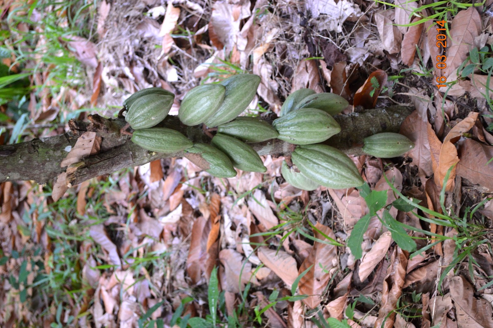
Sorry, flip the photo to the right please. The cocoa nuts are hanging down from the tree trunk.
Kwame showcasing a ripe cocoa nut.
Sorry, I forgot to take a photo of the interior of the nut because while I started to do so, ants from a branch above had discovered me somehow and I was a crawling mess being slapped to death by all kinds of kind hands.

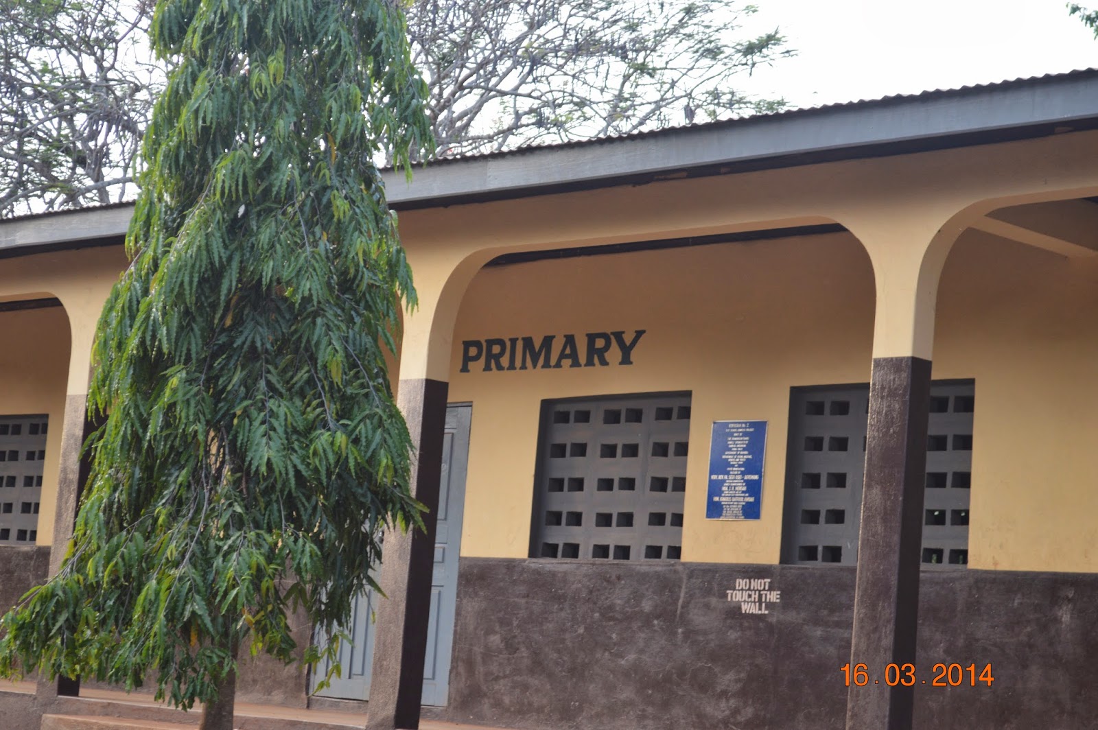
On the way between Kwame's farm and that of his brother we find this elementary school and apparently not much has changed. This was the primary school where Kwame went to school 54 years ago.

There is no electricity and no running water—the schoolrooms do have a chalkboard each. The windows are open so that a welcome breeze will be able to get in. Adequate actually. Teachers nowadays have their own quarters close by so that they don’t have to travel at all. 


To get back to Nana Kwame:
Only three of the five children of Kwame’s immediate family finished elementary school and only one went on to secondary school and then on to university on government scholarships. This was Nana Kwame.

Kwame explained that he got up every morning at three o’clock to do farm chores and to find time to study. His consistent studying eventually earned him scholarships to go to the nearby town Sunyani to attend high school. He lived in town with clan members because the walk to the village and farm would have taken hours. Eventually he graduated from high school and won more scholarships to go to the university where he read mathematics, as the British put it (the schooling system is based on the British as this is their former colony). Eventually he earned a master’s degree in mathematics and returned to Sunyani to become a high school teacher.  Nine years later there was an opening as mathematician at the Polytechnic College in the city, he applied and got the job.


Kwame still gets up as early as three in the morning, to read and grade. On a normal day he goes to bed at 7 pm this is pretty much when it is dark. 


We ended our tour of Kwame's farm with a visit to his brother's farm. We received a gracious welcome and we got to see how different the worlds can be between brothers. Below Nana Kwame is to the right, his brother to the left. In the background is Kwame's wife.


Within his community Kwame has taken on the position of elected chief and also advisor to the paramount Chief, the latter representing the highest position within the Akan Chieftaincy. This is a political/social structure that coexist with the democratic structure of the country--however, should the government make decisions that are not welcomed by the paramount Chief, the government might find itself at a loss at what to do. More on this topic tomorrow.

Suffice it to conclude that Nana Baah Korang gives back to the community with dedicated work in the traditional chieftaincy system, with committee work in his church (he is one of the elders there) and by raising one of his brother's sons because he hoped he would do better in school under his supervision than in the village, a hope that so far has not been fulfilled.


Thursday, March 13, 2014

Kakum National Park

Trip to Kakum National Park.
Kakum National Park is located within Cape Coast Region, northwest of the coast. Below is a map showing the regions of Ghana in color, Cape Coast Region is pink (to the west). Our final destination is the green region, Sunyani, to be precise. From there we will take some trips into other regions so I will refer back to this map.

Map of Ghana,
Kakum National Park is close to the coast.
The first stop was that of the canopy walk, a construction of seven hanging and swinging and swerving bridges, obviously high above ground. I had practiced balancing while exercising because I was determined to overcome my substantial fear of height. Ok, which I did in part thanks to my colleague Jeff who really helped when the swinging got really bad or when the ropes on the sides went too far down; by bridge four I was actually able to enjoy the scenery. Unsurprisingly we didn't see any animals; for one, many of the monkeys have become extinct, second, we were too many people  and third, it was the wrong time of day (noon). I wish I could have spent some night hours on one of those platforms with one other person who knows what whispering is. Below are some photos of the canopy system that was built 20 years ago.
High up in the trees--emergent trees are clearly visible.

After we recuperated from that walk we hiked to a very tall saba tree, a tropical wetland tree. The photo shows the buttress—enough for three people and more. The man in the middle is Sam, one of our four-person team.
Notice the space this tree buttress provides for three people!!

Photogenic Judi.